Case Studies

CGP Grey, http://www.cgpgrey.com. CC BY 2.0, http://creativecommons.org/licenses/by/2.0, via Wikimedia Commons.
Floodwaters accumulate as the Tar River overflows in Greenville, North Carolina. Photo by Coast Guard Petty Officer 3rd Class Corinne Zilnicki. Public domain

Chris Carnevale, Southern Alliance for Clean Energy. Used with permission

Marc Basnight Bridge crosses over the Oregon Inlet in the Outer Banks. Courtesy of North Carolina Department of Transportation.

Splash screen for NFWF Case Study: The Water Institute of the Gulf — Port Fourchon: Supporting Resiliency on an Evolving Coast

Aerial view of the City of Virginia Beach oceanfront. © City of Virginia Beach, Department of Public Works. Used with permission

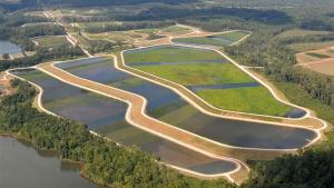
Clayton County Water Authority

C Watts, "Norfolk waterfront Virginia," Attribution 2.0 Generic (CC BY 2.0), https://www.flickr.com/photos/watts_photos/


