Screen capture from the Coastal Change Viewer

Alaska Coastal Change Viewer

Alaskan residents and land managers can use this viewer to explore the extent and rate of coastal change.

Travel the coast and rivers of western Alaska and you may notice places where landscape features are changing. This dataset—accessed through the Coastal Change Viewer—shows locations where relatively large areas of land have eroded away or sediment has been deposited between 1972 and 2014. While erosion is typically the greatest concern, areas with high sediment deposition can also create challenges, such as shifting river channels and narrowing lagoon or estuary entrances that can block travel.

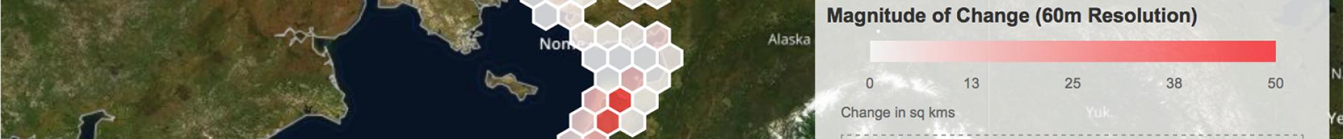
The dataset is based on Landsat satellite imagery from 1972–2014, and provides information on change in areas down to the pixel size of 60 square meters (about 200 x 200 feet, roughly an acre). Therefore, the results capture changes—as seen from above—of 200 feet or more. Results are most reliable for areas larger than five hectares (a bit more than 12 acres, or roughly 14 pixels). This series of images was analyzed by the Western Alaska Landscape Conservation Cooperative and ABR, Inc. to document changes in features such as spits, barrier islands, coastal bluffs, estuaries, tidal guts, lagoons, rivers, and lowland lakes close to the coast.

The results can be explored for any area within the study region (over 22,000 km of coastline, from Kotzebue to Kodiak Island, and reaching inland approximately 2 km). Explore change at a single hexagon or use the drawing tool to define a region of interest. The tool produces a table that summarizes the total area changed from land to water, or from water to land, as well as the percent change relative to the area in the chosen polygon. Zoom in to see the specific locations of those changes (for example, coastal areas or rivers or lowland lakes). Investigate changes in areas that are important to you, such as near infrastructure or important cultural sites. Data layers can be overlain to allow comparison (e.g., locations of airports and villages in the "Arctic Infrastructure" layer).

Last modified
10 May 2024 - 12:15pm