Alaska Shoreline Change Tool
This interactive map displays historic and predicted shoreline positions throughout Alaska. Users can explore the coasts of the state to see where the shoreline has been in the past, and where it will likely be in the future.
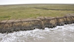
Historic shoreline positions were determined from aerial photographs and satellite imagery dating back to the 1950s. The Digital Shoreline Analysis System was used to calculate rates of shoreline change; the rates were then used to project future shoreline positions. Each predicted shoreline has a level of uncertainty associated with it: dashed lines represent a 90 percent confidence rating that the shoreline will be within that area for that year.
To use the tool, click zoom to the extent of one of the communities listed on the right. Then, select shorelines to display on the map. Find other interactive apps at the Alaska DGGS Geoportal.