Case Studies
Photo attributed to Diego Delso, delso.photo. Incorporated here under the terms of the license CC BY-SA. No endorsement by licensor implied.
This image is in the public domain, it contains materials that originally came from the U.S. Fish & Wildlife Service. No endorsement by licensor implied.
Tom Burke
Photo attributed to Michael Oswald. This work has been released into the public domain by its author. No endorsement by licensor implied.
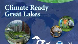
Screenshot from the Climate Ready Great Lakes training series.
Photo attributed to McGhiever. Incorporated here under the Creative Commons Attribution 3.0 Unported license. No endorsement by licensor implied.
Photo attributed to Lazy Lightning. Incorporated here under the Creative Commons Attribution 2.0 Generic license. No endorsement by licensor implied.
This photo has been released into the public domain because it contains materials that originally came from the National Aeronautics and Space Administration (NASA). No endorsement by licensor implied.
This image has been released into the public domain because it contains materials that originally came from the U.S. Department of Agriculture. No endorsement by licensor implied.
This image has been released into the public domain because it contains materials that originally came from the U.S. National Weather Service. No endorsement by licensor implied
Photo attributed to Mike Brennan. Incorporated here under the Creative Commons Attribution-Share Alike 2.0 Generic license. No endorsement by licensor implied.
(c) 2005 Derek and Julie Ramsey (Ram-Man). Incorporated here under the Creative Commons Attribution-Share Alike 2.5 Generic license. No endorsement by licensor implied.