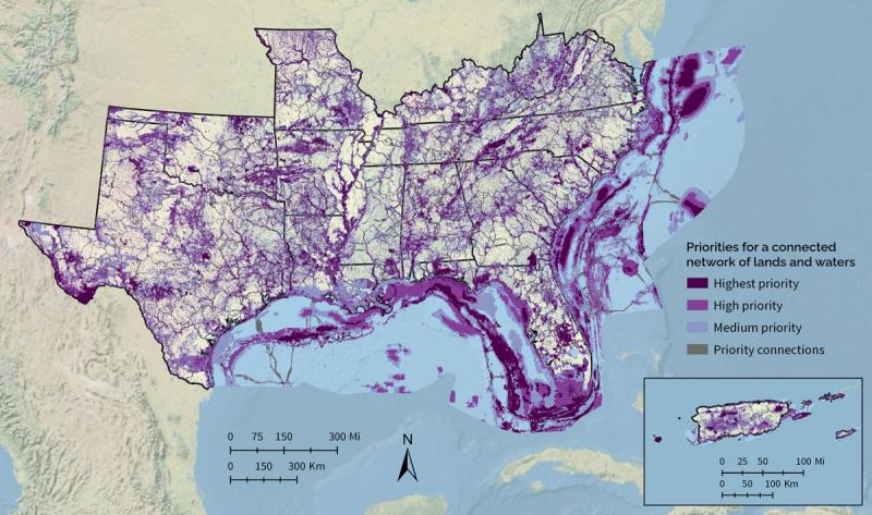
Southeast Conservation Blueprint
The Southeast Conservation Blueprint is the primary product of the Southeast Conservation Adaptation Strategy (SECAS), a regional conservation partnership that spans the Southeastern United States and Caribbean. The Southeast Blueprint is a living spatial plan to achieve the SECAS vision of a connected network of lands and waters.
The Blueprint identifies priority areas based on a suite of natural and cultural resource indicators representing terrestrial, freshwater, and marine ecosystems. A connectivity analysis identifies corridors that link coastal and inland areas and span climate gradients. So far, more than 2,000 people from over 500 different organizations have actively participated in developing the Blueprint.
More than 350 people from over 140 organizations have used or are using the Blueprint in their work. So far, the Blueprint has helped bring in more than $100 million in conservation funding to protect and restore over 200,000 acres. It has been used to inform public lands planning, strengthen land protection proposals, identify shared longleaf restoration priorities, refine natural habitat cores in local comprehensive plans, and much more.
You can access the Southeast Conservation Blueprint in 3 different ways:
- Start simple with the Blueprint Explorer to discover the Blueprint priorities and underlying data and generate a custom report for your area
- Visit the Blueprint page of the SECAS Atlas to dig deeper and overlay layers in an online mapper
- Download a complete data package for use in your desktop GIS

Map of the 2024 Southeast Conservation Blueprint. Visit the tool at https://apps.fws.gov/southeastblueprint/.

