Skip to main content
Main navigation
Case Studies
Mega Menu Icon
Image
Browse Case Studies
Filtered by hazard
Drought
Extreme Heat
Coastal Flooding
Flooding
Wildfire
Filtered by asset
Agriculture
Economy
Energy
People
Natural Areas
Workforce Development
American Samoa
Boston
Central Texas
Coastal Ohio
Los Angeles
Louisiana
Puerto Rico & USVI
St. Paul Island
Tools
Mega Menu Icon
Image
Browse Tools
Filtered by hazard
Drought
Extreme Heat
Coastal Flooding
Flooding
Wildfire
Filtered by asset
Agriculture
Community Services
Critical Facilities
Economy
Energy
People
Property
Natural Areas
Transportation
Water Infrastructure
Funding
Mega Menu Icon
Image
Browse Funding & Capacity
Funding & Building Capacity
Search for Funding Opportunities
Grant Development Resources
Steps to Resilience
Overview
Get Started
Understand Exposure
Assess Vulnerability & Risk
Investigate Options
Prioritize & Plan
Take Action
Contents
Mega Menu Icon
Image
Browse Popular Resources
Announcements
Steps to Resilience
New to the Toolkit?
Help Desk
Glossary
Case Studies
Tools
Trainings
Options Database
Organizations
Workforce Development
Topics & Sectors
Regions
Hazards
Assets
Submit
Breadcrumb
Home
Image
NPS Photo/Lampley
Seven Best Practices for Risk Communication
Image
Simple Planning Tool for Climate Hazards: Arkansas. Louisiana, Oklahoma, & Texas
Image
Extremes Tool - Record-setting conditions
Image
National Snow Analyses
Image
ACIS Climate Maps
Image
Pacific Island Sea Level Forecasts
Image
North American Marine Protected Area Rapid Vulnerability Assessment Tool
Image
National Adaptation Plans: Building Climate Resilience in Agriculture
Image
Thriving Earth Exchange (TEX)
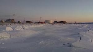
Image
Aerial view of Shaktoolik by Stefan Tangen. Used with permission
Defending in Place: Shaktoolik's Adaptation Plan Supports Local Decision Making
Pagination
First page
« First
Previous page
‹ Previous
…
Page
49
Page
50
Page
51
Page
52
Current page
53
Page
54
Page
55
Page
56
Page
57
…
Next page
Next ›
Last page
Last »
Subscribe to
Image Credits