Home
Main navigation
  • Mega Menu Icon
    Image
    case study icon
    Browse Case Studies
    • Filtered by hazard
      • Drought
      • Extreme Heat
      • Coastal Flooding
      • Flooding
      • Wildfire
    • Filtered by asset
      • Agriculture
      • Community Services
      • Critical Facilities
      • Economy
      • Energy
      • People
      • Property
      • Natural Areas
      • Transportation
      • Water Infrastructure
  • Mega Menu Icon
    Image
    data and tools icon
    Browse Tools
    • Filtered by hazard
      • Drought
      • Extreme Heat
      • Coastal Flooding
      • Flooding
      • Wildfire
    • Filtered by asset
      • Agriculture
      • Community Services
      • Critical Facilities
      • Economy
      • Energy
      • People
      • Property
      • Natural Areas
      • Transportation
      • Water Infrastructure
  • Mega Menu Icon
    Image
    funding icon
    Browse Funding & Capacity
    • Funding & Building Capacity
    • Search for Funding Opportunities
    • Grant Development Resources
    • Overview
    • Get Started
    • Understand Exposure
    • Assess Vulnerability & Risk
    • Investigate Options
    • Prioritize & Plan
    • Take Action
  • Mega Menu Icon
    Image
    popular resources icon
    Browse Popular Resources
    • Announcements
    • Steps to Resilience
    • New to the Toolkit?
    • Help Desk
    • Glossary
    • Case Studies
    • Tools
    • Trainings
    • Options Database
    • Organizations
    • Workforce Development
    • Topics & Sectors
    • Regions
    • Hazards
    • Assets

Breadcrumb

  1. Home
Image
powerlines in a field
  • Published on Wikimedia Commons under an Attribution-ShareAlike 2.0 Generic license
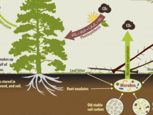
  • FEMP Training Catalog
    Image
    field with flowers surrounded by mountains
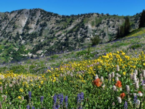
  • USDA, Forest Service 

  • Climate Change Education Modules
    Image
    green mountain scenery
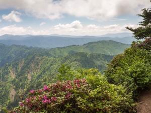
  • U.S. National Park Service
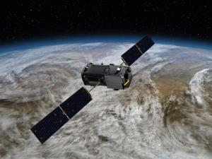
  • Interpreting Climate Change Self-study Modules
    Image
    satellite imagery of sea surface heights
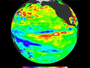
  • NASA-JPL/Caltech/Ocean Surface Topography Team

  • Selecting Climate Change Projection Sets for Mitigation, Adaptation, and Risk Management Applications
    Image
    solar panels and windmills with sunset
  • Published on Wikimedia Commons under CC0 1.0 Universal license

  • NASA Earth Observations for Energy Management
    Image
    satellite with earth in background
  • NASA

  • Introduction to NASA Resources for Climate Change Applications
    Image
    NASA ARSET logo over images of Johnson Spaceflight Center from the ground and from a satellite
  • NASA - https://appliedsciences.nasa.gov/get-involved/training/english/arset-building-climate-risk-assessments-local-vulnerability-and

  • Building Climate Risk Assessments from Local Vulnerability and Exposure
    Image
    diagram of the carbon cycle in forests
  • USDA

  • Technical Mitigation Options in Forests
    Image
    group of project managers around a large notepad
  • U.S. Army Corps of Engineers, Flickr, licensed under Public Domain

  • Climate Adaptation for Program Managers
    Image
    A book with a globe and green badge
  • CDC - https://www.train.org/cdctrain/course/1117398/details

  • Climate and Health: A Training for Health Department Staff

    Pagination

    • First page « First
    • Previous page ‹ Previous
    • …
    • Page 11
    • Page 12
    • Page 13
    • Page 14
    • Current page 15
    • Page 16
    • Page 17
    • Page 18
    • Page 19
    • …
    • Next page Next ›
    • Last page Last »
    Subscribe to

    Climate.gov
    • News & Features
    • Teaching Climate
    • Maps & Data
    • FAQs
    Main Menu
    • About
    • FAQ
    • Contact
    • Acknowledgments
    • Sitemap
    Latest
    • Funding Opportunities
    • Glossary
    • Announcements
    Partners
    • climate.data.gov
    • climate.gov
    • USA.gov
    • NEMAC
    Toolkit
    • Case Studies
    • Tools
    • Funding
    • Steps to Resilience
    • Popular Resources

    Climate Resilience Toolkit home link

    Required Footer Links
    • NOAA Privacy
    • Accessibility
    • FOIA
    • Information Quality
    • No-FEAR Act
    • Ready.gov
    • USA.gov